London wall
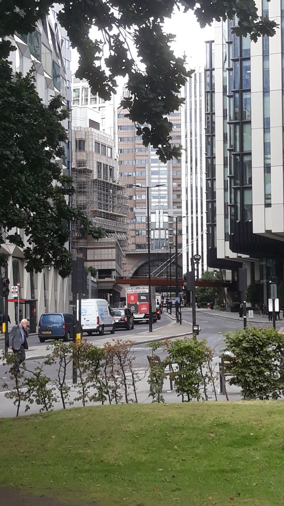
I was strolling through the City of London last week, on my way to a meeting and walking from Moorgate to Aldgate. I followed London Wall, which is in fact, not a wall but a large road (by City of London standards, it is a large road). I know London Wall well, and use it to navigate the City. It’s a point of reference for me. I cross it every time I go into the City, and when leaving. In my mind it creates a boundary, within which is the City and outside, the rest of London. I now take it for granted, I know its history, archaeology and conceptually.
But, what on earth is London Wall? What is it, physically, historically and archaeologically. What does it mean to us today and, as it is not tangibly present with us, what does it mean conceptually in our minds? That last one is subjective. No doubt the conceptual meaning is different for all of us.
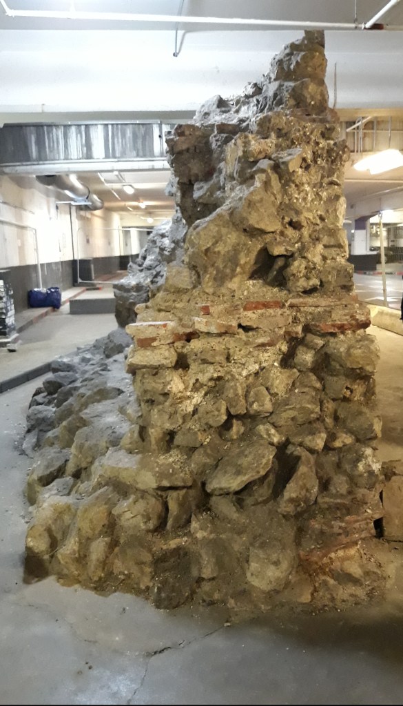
The Wall pops up in many places and represents many periods of London’s history. A large part of London Wall now is a road that runs on the eastern and northern part of the City from Aldgate into the southern area of the Barbican. Along this line parts of the Roman wall can be seen in underground areas, such as basements and car parks.
There are also chunks of it still buried underground, embedded into the subterranean fabric. It is known about, possibly recorded by archaeologists, but unseen. Only when new buildings go up and services are put in, does the wall rear its head and cause complications for developers.
But what is London Wall?
The Wall was built after Roman London, Londinium, had developed. Londinium was established around AD 53, and at that time, it was a small trading post with entrepreneurs and business people from across the Roman Empire. It developed, was sacked by Boudica in AD 60, rebuilt, and then burnt again during the Hadrianic Fire in the late 120s, early 130s. After this, Londinium really started to develop, with a monumental forum built of ragstone (limestone), a stone amphitheatre and public baths, all going up over a matter of decades. London Wall was built towards the end of that century, around AD 200.
There were two walls built. The first stretched around the landward side of the City, stretching from the Thames on the east, northwards, then west to the fort and finally southwards back to the Thames, and thus encricling Londinium. This first wall had only three sides, leaving the south waterfront open to the River Thames. Boats could easily moor with direct access to the warehouses that lined the wharf. The riverside wall, the second wall, was built later and is very different in nature to this first monumental wall.
This first wall was built in one stage, although it would have taken few years, perhaps decades, to do so. It was about two miles long and enclosed an area of about 330 acres. It is argued that the size of the wall made it one of the biggest construction projects in Roman Britain. The materials would also have made the project complex. It was made of the famous Ragstone, which the whole of Londoninium appears to be built of. The ground level on the external face was marked with a chamfered sandstone plinth. These materials needed importing to Londinium, as there was no building stone occurring naturally at hand. London is in a geological basin and the only decent local building material is clay, which the Romans used in abundance for bricks. But a town wall completely made of brick would not have cut the mustard, either for defensive, structural or monumental purposes. The limestone was from Kent and the sandstone was from much further away to the north in the Midlands, or going towards the West Country. Suffice to say, with quarrying, transportation and the skills required to build in stone, these materials did not come cheap.


The wall enclosed a large amount of land which at the time, was not completely used for buildings. There was a bit of industry, farming, dumps and wasteland within the walls. Don’t imagine a densely packed city that abutted the wall.

As the Wall left the waterfront open, we can assume that this first wall was monumental, not defensive. It is logical to think that the Wall was initially about the status of the City. Considering that it was at the end of a period of building large public structures, the amphitheatre, the forum, the baths, Londinium was being constructed as a statement of Roman civitas.
The riverside wall was built later and was made of a lot of re-used stone from inside the City. Parts of it have been excavated revealing re-worked stone and even relief sculpture embedded within the wall. This was possibly a response to a threat, with raiders attacking Londinium. It was more utilitarian than for show and put up a barricade style, using bits from here and there.
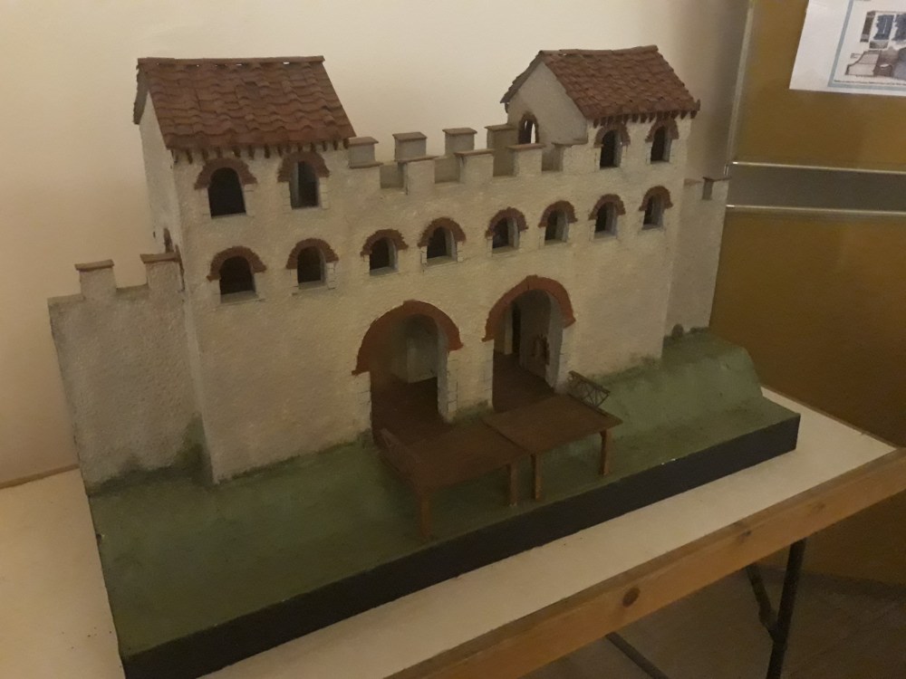
It is worth mentioning Cripplegate fort. Much of the remains we see in the north-western area of Londinium was part of a garrison fort, which like the forum and amphitheatre, pre-dated the wall. See the reconstructed birds-eye view above.
The Wall defined London over the next 1600 years. The Medieval City wall was built directly on the Roman wall to create its defences. It is clearly represented on maps, including my favourite the Agas Map from the 1560s. As city defence became less important, and London grew beyond its boundaries, buildings, workshops, houses, were built onto the wall, integrating it into people’s businesses and lives.

It still very much in our landscape today. You can see parts of the original Roman Wall, the most famous of which is on the east side of the City, just next to Tower of London. This wall would be the first people would see of Londinium when arriving by river. Today it is crowded with tourists from abroad, arriving usually by tube, so still pass this point on their way to the Tower.
You can see chunks of it in car parks and basements of buildings (usually out of bounds to the public). I have heard stories of glowing orbs floating aorund the Wall in these areas. I don’t want to get distracted though.
There are large sections in the Barbican and down Noble Street where Shakespeare lived for a short period (see Shakespeare in London). I wonder if he ever thought of the Romans when walking past the wall – probably not. Sometimes, it is the Roman wall you see, sometimes it is the medieval, Victorian or a mixture of many periods.

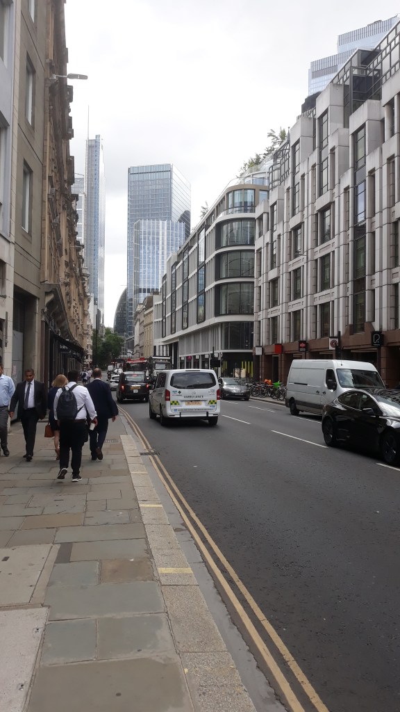
Most of the Wall is represented by that road, London Wall, which runs from Aldgate, follows the original route and ends by the Museum of London. On the West side, I have always found it difficult to trace its exact route. It seems to have been lost in the Medieval street plan. But there is a large late Victorian road, Farringdon Street, that runs up the western side of the City of London. Although not on the exact spot of the Wall, it runs almost parallel to the Fleet river, which was the natural western boundary of the Roman City. One would have to cross a bridge over the Fleet to gain access to London from the west. Today this road itself creates a boundary between the City and the rest of the Greater London. To cross it, you have to go to the controlled crossing point, the traffic lights.
A conceptual London Wall
As with much of my writing, I like to think about these things, go a bit deeper and even take a conceptual view. There is some very early conceptual thinking about the wall. Well, smatterings of thinking at least. In the centuries after the Roman withdrawal from Britain, Londinium was abandoned and the invading Saxons did not settle within the walls. There has been much written about the reasons why and I’ve looked at this in Dark Earth. The Saxons established a settlement just to the west, Ludenwic, but not in Londinium, within the walls. Today, many consider this was superstition, the walled Londinium being a place of spirits and not to go into. To me, it is logical. The Saxon settlers built out of wood, not stone. When setting up a new settlement, it makes sense to keep doing what you know and build in wood, instead of learning how to build and maintain stone buildings.
Saying that, though, there are poems, myths and legends from this time, about ancient giants, who were the builders of stone walls and buildings. Did they consider these walls, which were still very much in place, were built in the deep past by by giants? There are many stories of giants and London, and the City of London has two of its very own giants, Gog and Magog. They head the Lord Mayor’s Parade every year and keep watch over the Guildhall from the minstrels’ gallery.

Before I go off down that route, let’s get back to the Wall. Boundaries don’t disappear that easily, even when walls have been pulled down. Today the main impact of the Roman Wall is on the shape and footprint of the modern City. I’ve written something similar in the other posts about the shape of towns, see Ancient Towns, Ancient Teeth. When a boundary is created, it is bulit on, again and again and stays with us.
As you past this boundary, although, amost invisible, changes to occur. There are differences in the nature of the City of London. When you enter, look for the architectural changes, with post war modernism and brutal structures appearing, and recently, the latest defining barrier and statment, the large city tower blocks of glass and steel (see London is a Roman Creation). The nature of the roads change; the layout and dimension of them are more medieval. There is also the more tangible change in the City, a different police force, economy, governance and its own Lord Mayor.
Is there something that has continued through time, down the generations, and into our present-day psyche? I think so. Do people going into the City know about this boundary or even pick up on it at a subconscious level? Is it because I know about it that I see its patterns in the landscape?
Or is it a result of people within the City looking outwards. They have maintained the boundaries, creating a distinct City that is unique to the rest of London, but only know of it themselves.
The Wall is not present with us now; it is intangible, but there is a significant impact on us today and how it shapes our physical world. To me, the Wall still remains a barrier, a boundary, a definition. Within it is the City of London, a separate place to the rest of London. As I cross London Wall on my commute, I am doing what millions of people have done over the many, many years. I arrive at Moorgate, and wait at the junction with London Wall for the Green Man to come alive so that I can cross into the City. It is still a barrier with controlled access, just like the gateways in the image above.
If you are ever going to trace the Roman Wall and walk the route, work form east to west, starting at the Tower of London. That way you will see much of it early on, not get disheartened by the myriad of small streets in the western area, and can end up in the Blackfriars pub.
Further reading
A lot has been written on the London Wall and you won’t have trouble finding somethign online quickly. A great study of Londinium is Richard Hingley’s Londinium, A Biography.
Richard Hingley, 2018, Londinium: A Biography, Roman London from Its Origins to the Fifth Century.
Maps
You can trace the route of the Wall on this planning map for the City of London: https://www.mapping.cityoflondon.gov.uk/geocortex/mapping/?viewer=compass&runworkflowbyid=Switch_layer_themes&LayerTheme=Show%20the%20Explore%20The%20City%20layers
Scroll down the left and click on the “Scheduled Ancient Monuments” tab. It will appear in brown. You will also see all the Schendules Ancient MOnumnets in London, inlccuing the Amphitheatre and Forum.
The Agas Map can be looked at in great detail here: https://mapoflondon.uvic.ca/map.htm
Giants
I found this blog on the Foyles website very good overview of giants and ealry mythology https://www.foyles.co.uk/blog-giants-of-london
Walks
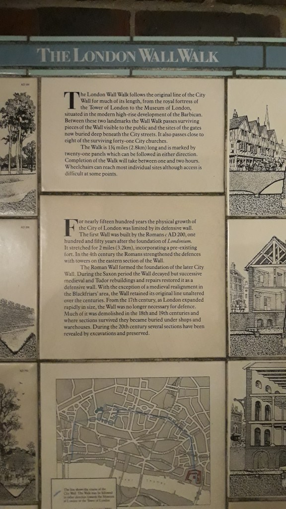
There are many walks you can take around the wall, either guided or online. Look out for these fantastic cermic tiles explaining history and archaeology of the Wall.

“As the Wall left the waterfront open, we can assume that this first wall was monumental, not defensive. It is logical to think that the Wall was initially about the status of the City. Considering that it was at the end of a period of building large public structures, the amphitheatre, the forum, the baths, Londinium was being constructed as a statement of Roman civitas.” And also to control trade perhaps? So you can levy taxes on the flow of goods and check people coming and going?
LikeLike
Hello Sue. Absolutely – there’s always the financial bottom line and Britain was a bit of an earner for Rome. It looks like the maritime trade was moved further down stream to Shadwell around the time the riverside wall was built. It’s possible that may have had a better control on trade. H
LikeLike